North central states in Nigeria
'Nigerian states' is quite an interesting topic. The territory of Nigeria is divided into 36 states and one Federal Capital Territory, which, in turn, is divided into 774 Local Government Areas. After gaining independence in 1960, Nigeria was divided into three regions according to the ethnoreligious principle: Northern, Western, and Eastern.
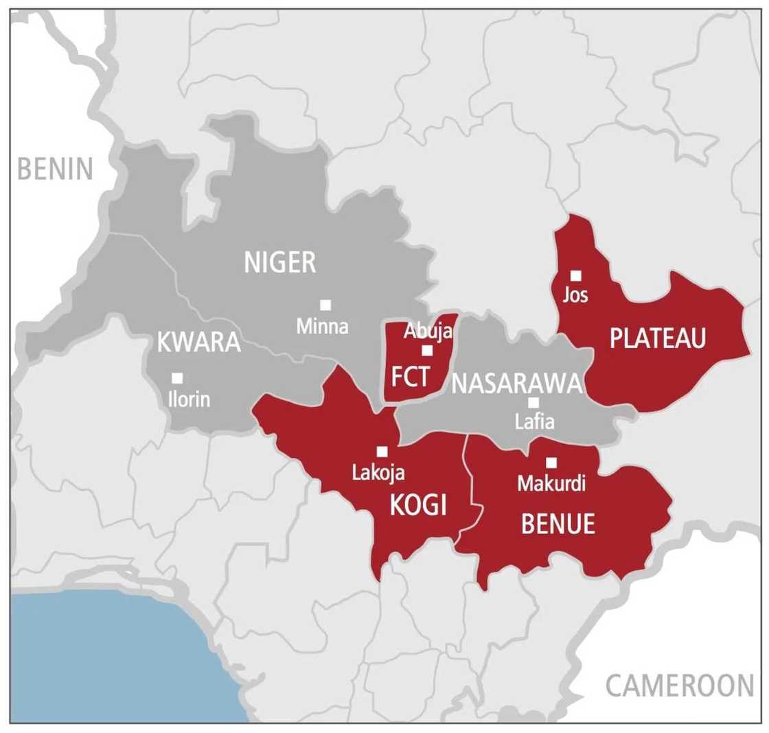
In 1963, the Midwest area was formed from two provinces of the Western area. In 1967 the areas was disbanded and replaced with 12 states directly subordinated to the federal government. Later seven more states, which are included on the list of states in Nigeria were formed.
North central states in Nigeria
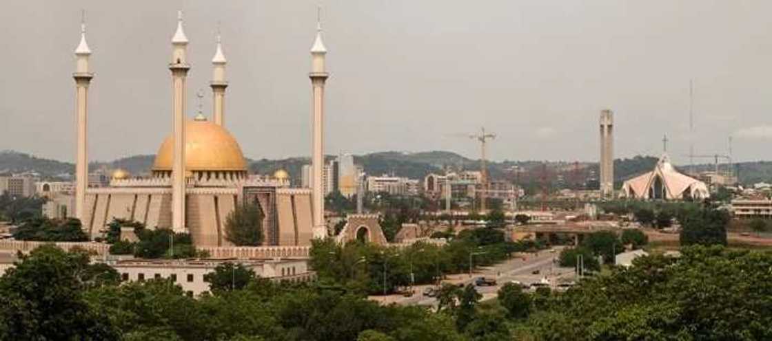
Abuja
Abuja became the capital of Nigeria recently, at the end of 1991, having taken this position from the city of Lagos. The decision to transfer the capital to this city was taken in the 1970s. The authorities who chose this city were guided by the fact that in a capital city no group should dominate whether political, ethnic, or religious. The country was tired of various conflicts and needed the capital to unite people. The capital of Abuja was built courtesy of a Japanese architect.
The history of Abuja started in 1828 and this turned into the capital one and a half centuries later. Now, Abuja is a modern city, with modern architecture, which so harmoniously fits Africa. Now the population of the city is more than one and a half million.
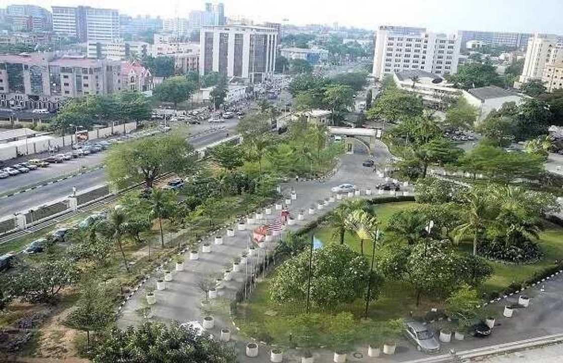
The city is territorially divided into six areas. In the central area, there are office buildings, including the residence of the president.
Abuja is located in a picturesque valley, practically in the center of Nigeria. The nature around the city abounds with beautiful hills. Savannas of the North near the city trail into the rain forests leaving the other regions on the south. The climate in Abuja is equatorial, with obviously expressed rainy seasons and with the average annual temperature of about thirty degrees.
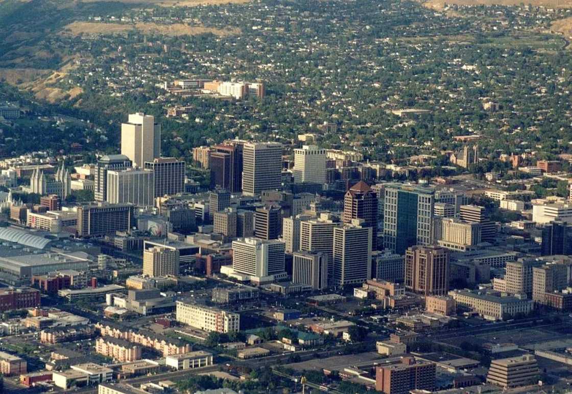
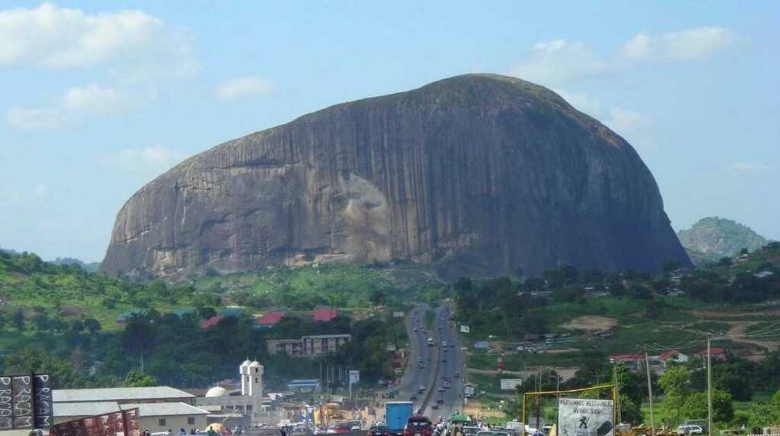
Among the sights of Abuja, the popular ones are the granite hill, Zuma and the national mosque of Abuja with a golden dome and four minarets. The road to the city leads straight to Zuma. Thousands of tourists visit this hill as it is quite interesting. According to national beliefs, it has some healing forces. Abuja is a very cozy city. Constructed according to plan and very accurately, it is one of the most beautiful cities in Africa now. The city consists of the several districts:
- Central;
- Garki;
- Wuse;
- Maitama;
- Asokoro;
- Gwarimpa.
Benue State

Benue is one of the states in Nigeria and it is in the southeastern region. This state in Nigeria, takes the 11th spot in the area and 9th in terms population. The administrative center of the state is Makurdi city. The population of the state is about 4.256.641 based on the population census in 2006. The main ethnic groups inhabiting the state are Tiv, Idoma, Igede, Etulo, and Abakwa. Benue shares borders with Nasarawa in the north, Taraba State on the east, Cross River State on the south, Enugu on the southwest and Kogi on the west. Because of a geographical location, the state is referred to as the state the food basket of the country, because it has a rich agricultural area.
Many grain crops are grown in this state: potatoes, cassava, soy, flax, yam, rice, and peanut. In an attempt to encourage higher education among the population, the state has three universities: the Federal University of Agriculture Benue, Benue State University, and Mkar University. Also, there are two polytechnics: Benue State Polytechnic and Fidel Polytechnic.
Benue State is located in the center of Nigeria between the nomads of the North and farmers of the South. In these parts, there is regular conflict between for the right of use of the land and water resources. Due to the rapid growth of the population and corresponding expansion of business activity of the zone, these conflicts take place more often and more brutally.
Kogi state
READ ALSO: Geopolitical zones in Nigeria and their states
Kogi is a state in Nigeria. It is called The Confluence State based on the capital of the state, the city of Lokoja. This was the first administrative capital in Nigeria and it was created as a confluence of Niger and Benue. The state was formed in 1991 from parts of the states of Kvar and Benue. Now several tribes, including Yoruba, Igala, and Ebira live in the state. The state of Kogi, thanks to the unique geographical location, offers various opportunities for relaxation.
There is an interest the wild nature, historical monuments and culture. Being that the state is not so far from the capital of the country, Abuja, tourists can plan one-day trips to the places they find interesting. Important sights of the state are colonial monuments, such as, the house of Lord Lugard, the place of confluence of Niger and Benue, Ogidi (the African city with the extraordinary forms of rocky stones (Igneous Rock) and traditional crafts.
The Kogi state connects the Federal Capital Territory to 22 southern states. Being close to the Federal Capital Territory, the international airport of the city of Abuja serves internal and international flights. In the state, telecommunication services are also well developed.
Kwara state
Kwara is one of 36 Nigeria states. The capital city of the state is Ilorin. It is 306 km northeast of Lagos and 500 km southwest of Abuja. Kwara state was created in 1967 when the Federal Military Government changed the division of the state into 12 regions.
The state was created from the former provinces Ilorin and Kabba of the Northern Region and was originally called the West Central state, but was renamed into Kwara later — the local name of Niger River. Since 1976, Kwara state has considerably decreased in size as a result of further changes to the state system of Nigeria.
On February 1976, the Dekina area was allocated and merged with a part of Plateau to form the state of Benue. On August 1991, five areas were also allocated to form a part of the new Kogi state, and the sixth area was merged with Niger.
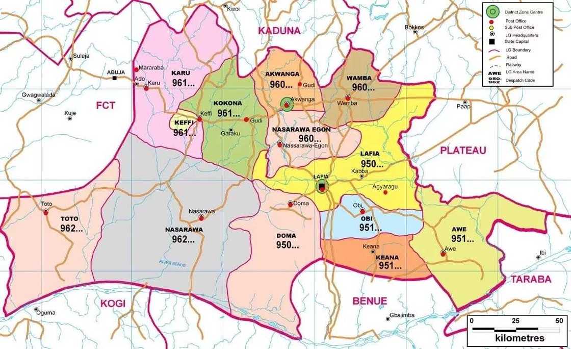
Nasarawa State is one of the Nigerian states in the central region. It is the 15th in the area and 35th when it comes to its population. The capital city of the state is the city of Lafia. Nasarawa is an agricultural state in Nigeria with big fields. It was formed in October 1996 by the Plateau state. Tourists in Nasarawa go there for agriculture, fishing, knitting and other needlework.
The state is also rich in various minerals, which play a huge role in economically viable industrial and agricultural projects. Among these minerals, there are tin, marble, coal, and semiprecious stones. There are also many unused energy resources; therefore, the state is often called ‘The Home Of Solid Minerals.'
Niger State

Niger State is one of the states in the central part of Nigeria. The capital center of the state is the city of Minna. It was founded in February 1976. It was created according to stipulations of Sharia law, although a considerable number of Christians lives here. People who speak the Hun-Saare language also live in the state.
Niger state received its name from River Niger, which forms one of its natural borders. Because of the location, the state of Niger is the homeland of the two largest hydroelectric power stations in the country. 3 main ethnic groups – Nupe, Gwari, and Hausa reside here. There are also smaller groups, such as Corot, Kadara, Kambari, Kamuku, Pangu, Bassa, Fulani, etc. Niger state also has the national park of Kainji, the largest National park in Nigeria. A large number of people in the state are farmers.
Plateau State

Plateau State is one of the states in the central part of Nigeria. The capital of the state is Jos. It got its name from the Plateau Jos, where the state is located. It was formed in February 1976 at the partition of the Benue-Plateau state. In 1996 Nasarawa State separated from its western region. In the beginning of the 20th century, most part of the modern state of Plateau entered the province of Bauchi.
In 1926, the Plateau was separated from Bauchi. Then the borders of the province changed several times. At the reform of administrative division of Nigeria of 1967, when the country was divided into 12 states, the states of Benue and Plateau were merged into the state of Benue-Plateau. At the partition of the state in 1976, the new Plateau state was formed from the borders of Plateau state sample of 1967.
Conclusion

In total, there are seven different states in the North central part of Nigeria. All of them have their unique history and are very useful for the economy of the country.
READ ALSO: North West states in Nigeria
Source: Legit.ng


